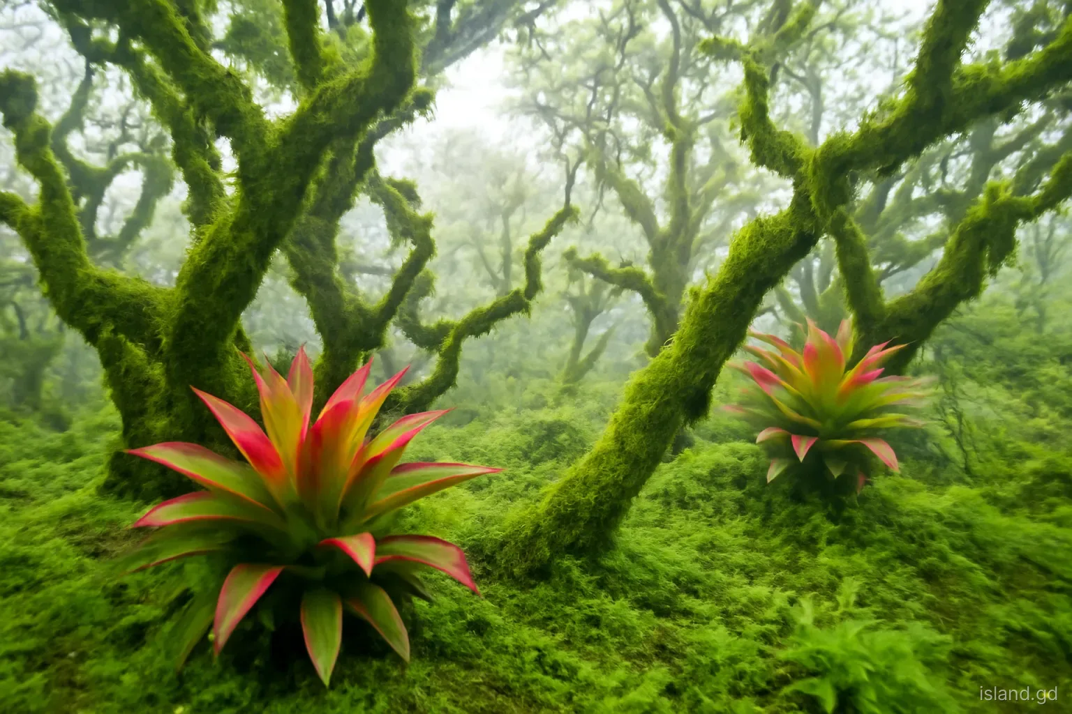
In a single drive from Point Salines to Grand Etang, Grenada passes through several distinct types of vegetation. The arid scrub and cactus of the south coast give way to farmland and secondary forest on the lower slopes, then to tall, dripping rainforest in the mountains, and finally, on the highest peaks, to a stunted, moss-draped woodland that hardly looks tropical at all. The changes are driven by rainfall, altitude and exposure to wind, and they compress into a small island a range of habitats that would stretch across a much larger landscape elsewhere.
This guide explains Grenada's main forest zones, from the coast to the summits, and the plants that characterise each one. It is aimed at curious walkers rather than botanists, and it focuses on what you can recognise on the ground. Names vary between local, English and scientific usage, so local guides may use different terms; asking them is one of the best ways to learn the forest.
The coast: mangroves, dry scrub and seasonal forest
Along sheltered coasts and in lagoons, mangroves grow where salt water meets fresh. Grenada's mangroves, found in places such as Levera in the north, the south coast bays and parts of Carriacou, including the north side of Tyrrel Bay, are made up of trees adapted to salt and waterlogged mud, with tangled prop roots and breathing roots that rise above the water. They shelter young fish, filter sediment and protect the coast from storm surge, which is why they are protected.
The driest parts of mainland Grenada, the south-west peninsula and the low hills of the south coast, along with much of Carriacou and Petite Martinique, support dry scrub and seasonal forest. Here, plants are adapted to long dry spells: cacti, thorny acacias, the aromatic shrubs of the coast and trees that drop their leaves in the dry season. Manchineel, a tree common along beaches, has a toxic sap and fruit; never shelter beneath it in rain or eat the small green apples. Inland, on lower slopes with more rain, these grade into mixed deciduous and semi-evergreen forest, much of it altered by centuries of farming.
The lower slopes: farmland, secondary forest and bamboo
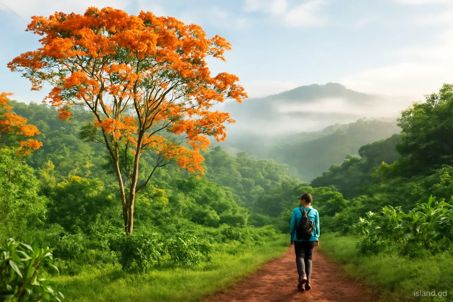
Much of Grenada's lower and middle slopes has been cultivated for centuries, first for sugar and later for cocoa, nutmeg, bananas and other crops. As a result, a great deal of the forest seen from the road is secondary, regrowing on former estates, or a mosaic of farmland and woodland. Nutmeg and cocoa trees grow under taller shade trees, including immortelles, which flower bright orange in the dry season, and fruit trees such as mango, breadfruit and golden apple are everywhere.
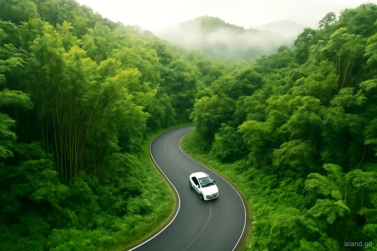
Clumps of bamboo line many roads and riverbanks, especially in the interior. Bamboo is not native to Grenada; it was introduced and planted, partly to stabilise slopes and riverbanks, and it now forms dense, creaking groves. Other introduced plants, from ornamental flowers to timber trees, are part of the modern landscape. Recognising this layered history helps explain why the forest near roads and villages looks different from the more natural forest higher up in the reserves.
The montane rainforest: Grenada's tall forest
Where it grows. In the mountains of the interior, including the Grand Etang Forest Reserve and the slopes of Mount St Catherine, high rainfall supports tall, evergreen rainforest with a closed canopy.
Gommier. One of the characteristic large trees of the Windward Islands' rainforests, with a straight trunk and smooth, pale bark. Its trunks have traditionally been used for dugout canoes in parts of the region.
Bois canot. A fast-growing tree with large, hand-shaped leaves that are silvery underneath, common in gaps and on disturbed ground, especially after storms.
Planted timber trees. Mahogany and blue mahoe were planted in parts of the forest reserves during past forestry programmes and are now part of the canopy in some areas.
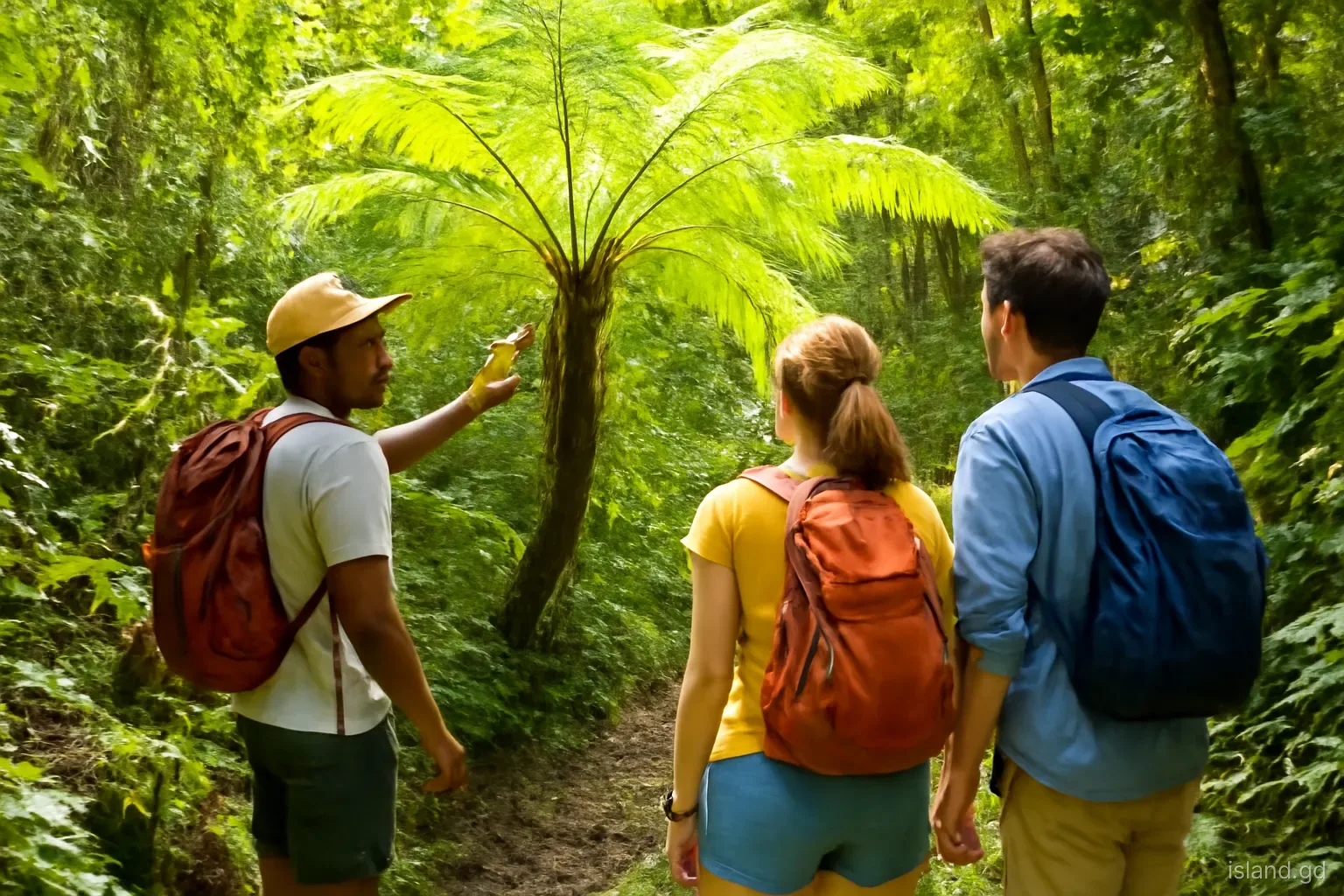
Tree ferns. Graceful tree ferns, with a single trunk crowned by a rosette of fronds, are abundant along trails and roads in the wetter forest.
Epiphytes and climbers. Bromeliads, orchids, mosses and ferns grow on trunks and branches, while lianas and climbing aroids twist up into the canopy. Heliconias, with their red and yellow bracts, flourish in clearings and along streams.
Along the rivers: the riverside forest
Grenada's rivers and streams carve through every zone, and the strips of vegetation along their banks form a habitat of their own. In the mountains, streams run under a dense canopy, with ferns, mosses and wild ginger growing on wet rocks and banks. Lower down, rivers widen into rocky valleys lined with bamboo, heliconias and tall trees whose roots grip the banks against floods. Waterfalls and their spray zones support especially lush growth, with filmy ferns and mosses coating the rock faces.
These riverside strips are important for wildlife, providing water, shade and corridors along which birds and animals move between forest patches. They also protect riverbanks from erosion during heavy rains. Where trees along rivers have been cleared for farming or building, banks are more prone to collapse and rivers carry more sediment to the sea, which in turn affects reefs along the coast. For walkers, river valleys are among the most beautiful parts of the forest, but they are also where flash floods strike first, so treat them with respect in rainy weather.
The summits: palm brake and elfin woodland
On the highest ridges and peaks, including the summit areas of Mount St Catherine and Mount Qua Qua, the forest changes dramatically. Constant cloud, strong winds, cooler temperatures and waterlogged soils stunt tree growth. Trees become short and gnarled, with twisted trunks and small, leathery leaves, and almost every surface is covered in moss, liverworts, filmy ferns and bromeliads. This is elfin woodland, sometimes called cloud forest or montane thicket, and walking into it feels like stepping into a dripping, green-tinted world.
In some exposed areas, palm brake forms, dominated by mountain palms that cope with wind and saturated ground. These summit habitats are small in area and fragile. They support specialised plants and insects, and they play an important role in capturing moisture from cloud, which drips into the soil and feeds streams far below. Because they are slow to recover from damage, it is especially important to stay on paths and avoid trampling or collecting plants when visiting the peaks.
Storms, recovery and conservation
Hurricanes are part of the forest's natural history. Hurricane Janet in 1955 and Hurricane Ivan in 2004 both caused severe damage to Grenada's forests, stripping leaves, snapping trunks and uprooting large trees across the interior. After Ivan, many slopes around Grand Etang were left with a broken canopy. Fast-growing pioneer species, such as bois canot, filled the gaps first, followed over time by slower-growing trees. Visitors today walk through a forest that is still recovering, with a mix of young and old trees.
Grenada's forest reserves and national parks are managed by the government's forestry and national parks authorities, with the support of community groups and international partners. Protection matters for wildlife, but also for water: the forests of the central mountains capture and store rainfall that supplies rivers and much of the island's drinking water. Threats include unauthorised clearing, illegal dumping, invasive species and the growing intensity of storms associated with a warming climate. Supporting licensed guides, staying on trails and leaving plants where they grow all help.
How to read the forest on a walk
A few simple habits turn a walk into a lesson in Grenada's ecology:
- Watch the altitude change. Notice where farmland gives way to secondary forest, and where tall rainforest gives way to stunted, mossy trees near the summits.
- Look up and look close. Many of the forest's plants grow on other plants; scan branches for bromeliads and orchids, and look at bark for mosses and tiny ferns.
- Read the gaps. Clearings full of bois canot and heliconias often mark places where storms or landslides opened the canopy.
- Listen. Birdsong, frogs and running water change with altitude and time of day.
- Ask the guide. Local guides often know traditional uses of plants, local names and stories that no field guide includes.
- Take only photographs. Collecting plants, orchids or seeds from forest reserves is not allowed and damages fragile habitats.
Frequently asked questions
Does Grenada have a real rainforest?
Yes. The mountains of the interior, including the Grand Etang Forest Reserve and the slopes of Mount St Catherine, support tall evergreen montane rainforest with tree ferns, epiphytes and a closed canopy. On the highest peaks, it gives way to stunted, moss-covered elfin woodland shaped by constant cloud and wind.
What is elfin woodland?
Elfin woodland is a stunted forest found on the highest, cloudiest and windiest peaks, such as Mount St Catherine and Mount Qua Qua. Trees are short and twisted, and branches are thick with mosses, ferns and bromeliads. It plays an important role in capturing water from cloud.
Is bamboo native to Grenada?
No. Bamboo was introduced to Grenada and planted, partly to stabilise riverbanks and slopes. It now forms large groves along roads and rivers in the interior, especially around the central mountains, and has become a familiar part of the landscape despite not being native.
What is the dangerous tree on Grenada's beaches?
The manchineel tree, common along beaches in Grenada and Carriacou, has toxic sap and small green apple-like fruit. Do not eat the fruit, avoid touching the sap and never shelter beneath it in rain, as dripping water can carry the irritant onto skin and eyes.
How did Hurricane Ivan affect Grenada's forests?
Hurricane Ivan in 2004 caused widespread damage to Grenada's forests, snapping and uprooting trees and stripping the canopy across much of the interior, including around Grand Etang. The forest has been regrowing since, with fast-growing pioneer trees filling gaps first and slower species following over time.