Grenada's coast is where most of the country lives, works and travels. St George's wraps around its harbour, the main road follows the shoreline for long stretches, Grenville, Gouyave, Sauteurs and Hillsborough all sit at sea level, and the beaches that drive tourism are narrow strips of sand between the sea and hotels, roads or villages. Rising seas and stronger storms put that whole arrangement under pressure.
Global average sea level has risen by roughly 20 centimetres since 1900 and is now rising faster, at several millimetres a year. Scientific assessments project a further rise by 2100 that could range from around 30 centimetres to a metre or more, depending largely on future emissions. On a small island with a narrow coastal plain, even modest rises magnify storm surge, erosion and flooding. This article explains where Grenada's coast is most exposed and how communities are responding.
Why Grenada's coast is so exposed
Grenada is volcanic and mountainous, so flat land is scarce and concentrated along the coast. Towns grew around harbours and river mouths, and roads were built along the shore because the interior is steep. That pattern leaves housing, businesses, utilities and transport routes very close to the sea.
The two sides of the island behave differently. The Atlantic east coast faces the trade winds and ocean swell, with higher wave energy and more erosion. The Caribbean west and south coasts are sheltered most of the time but exposed when storms or unusual swells approach from the west or south.
Carriacou and Petite Martinique are low and dry, with settlements such as Hillsborough, Windward and Harvey Vale close to the shore. Lauriston Airport on Carriacou sits on low coastal land, and much of the island's infrastructure is within a short distance of the sea.
Where change is most visible
Grand Anse and the south-west beaches. Grand Anse, the country's most famous beach, has experienced periods of erosion and narrowing, with sand shifting during storms and swells. Development close to the beach limits the room sand has to move.
The east-coast towns. Grenville and smaller communities along the St Andrew and St Patrick coastline face Atlantic waves. Seawalls and coastal roads in these areas require constant repair.
The west-coast road. The road north from St George's through Grand Roy, Gouyave and Victoria runs close to the sea, and high waves can damage seawalls and flood low points.
St George's waterfront. The Carenage and low parts of the capital can flood when heavy rain coincides with high tides or storm surge.
Carriacou's shoreline. Erosion affects beaches and coastal roads on Carriacou, while islets such as Sandy Island have changed shape after storms. Beryl in 2024 caused significant coastal damage on the sister isles.
What drives erosion
Sea level rise is one factor, but erosion in Grenada has several causes working together. Storms and swells move large volumes of sand in short periods, and in a healthy system much of it returns. When the backshore is occupied by walls, buildings and roads, sand cannot retreat inland, so the beach narrows.
Human activity has played a major part. In the past, sand was mined from beaches for construction, removing material that natural systems could not replace. Beach sand mining is now restricted, but its effects linger in some places. Clearing coastal vegetation and mangroves removes natural buffers, and poorly designed seawalls can deflect wave energy onto neighbouring stretches.
Coral reefs also matter. Healthy reefs break waves offshore and supply sand from broken coral and the organisms that live on them. Reef degradation from warming seas, pollution and disease reduces both protection and sand supply, so the health of the coast depends partly on what happens underwater.
Storm surge, the hidden danger
Grenada's normal tidal range is small, well under a metre, so day-to-day changes in water level are modest. The serious threat comes from storm surge: a temporary rise in sea level driven by strong winds and low pressure during hurricanes and tropical storms, topped by large waves. Surge can push seawater well beyond the normal shoreline, flooding low streets, damaging foundations and eroding beaches in hours.
Rising sea levels make surge more damaging because each storm starts from a higher baseline. A surge that once stopped short of a road may now cross it. Heavy rain at the same time can trap water in low areas, since drains cannot empty into a raised sea.
Areas most at risk include low-lying parts of St George's, east-coast communities such as Grenville, and coastal villages on Carriacou and Petite Martinique. Hurricane preparedness plans increasingly treat surge zones as places to evacuate, not just shelter in.
What is being done
Responses combine engineering, planning and nature-based approaches, with varying success:
- Seawalls and revetments protect key roads and buildings, particularly in towns. They work locally but can increase erosion nearby and do not preserve beaches.
- Coastal setbacks require new buildings to be placed a minimum distance from the high-water mark. The Physical Planning Unit reviews coastal applications, though enforcement and older buildings remain challenges.
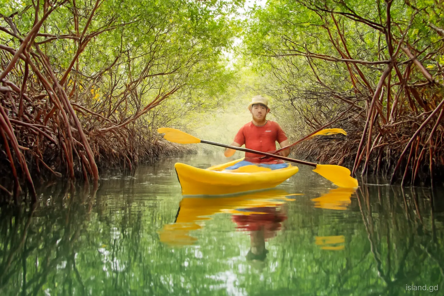
- Mangrove and vegetation restoration in places such as Carriacou and the south coast aims to restore natural buffers against waves and surge.
- Reef protection through marine protected areas and coral restoration projects supports long-term coastal stability.
- Drainage improvements in towns reduce flooding when heavy rain meets high tides.
- Climate adaptation programmes, often funded by international partners, combine these measures with community planning and data collection.
How to read the signs of erosion on a beach
Anyone walking Grenada's beaches can learn to spot erosion. These signs suggest the shoreline is retreating or under stress:
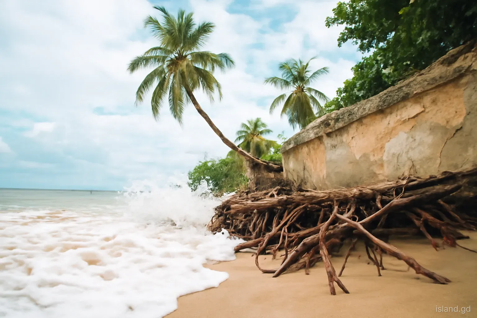
- Coconut palms and sea grape trees with exposed roots, leaning or fallen into the sea.
- A steep step or scarp in the sand at the top of the beach, cut by waves during high water.
- Seawalls, steps or foundations with their bases exposed or undermined.
- Old concrete, pipes or rubble emerging from the sand where they were once buried.
- Very narrow sand at high tide, with waves reaching walls or vegetation.
- Dark layers or rocks showing where sand used to cover them. Some of these features change seasonally, so a single visit is not conclusive, but a combination over years is a clear warning.
Mistakes to avoid if you build or buy near the coast
Trusting today's shoreline. A beach that looks wide in the dry season can shrink dramatically after a winter swell or a storm. Ask long-time residents how the shoreline has changed.
Ignoring setbacks. Building too close to the sea can mean refused approvals, fines or demolition orders, as well as exposure to surge. Check requirements with the Physical Planning Unit first.
Hard defences without advice. Building a private seawall without engineering advice can make erosion worse and damage neighbours' property. Coastal works generally require approval.
Removing vegetation. Clearing sea grape, coconut palms or mangroves for views or access removes the natural protection that holds sand in place.
Underestimating insurance. Coastal properties may face higher premiums or exclusions for flood and surge. Confirm cover before committing.
Looking ahead
Grenada is a small contributor to global emissions but highly exposed to the consequences, a position shared by small island developing states across the Caribbean and Pacific. Grenada has been active in regional and international climate negotiations, arguing for faster emissions cuts and for finance to help vulnerable countries adapt and address loss and damage.
At home, the challenge is to plan for decades of change while dealing with immediate needs. That means mapping vulnerable areas, guiding new development away from the most exposed land, protecting reefs and mangroves, and preparing communities for difficult decisions about infrastructure that cannot be protected indefinitely.
For residents and visitors, small choices help: respecting protected areas, keeping off dunes and vegetation, supporting businesses that follow setback rules and paying attention to what local organisations say about the coast.
Frequently asked questions
Is Grenada threatened by sea level rise?
Yes. Much of Grenada's population, roads, towns and tourism infrastructure lie along the coast. Rising seas increase erosion, flooding and storm surge, and projections for this century range from tens of centimetres to a metre or more depending on global emissions. Low-lying parts of Carriacou are particularly exposed.
Is Grand Anse Beach eroding?
Grand Anse has experienced periods of erosion and narrowing, especially after storms and swells, and development close to the sand limits its ability to recover naturally. Its condition changes over time, so observations from a single visit may not reflect the long-term trend.
What causes beach erosion in Grenada?
Erosion results from storms and swells, rising sea level, past beach sand mining, loss of coastal vegetation and mangroves, degraded coral reefs and buildings or walls that stop sand from moving naturally. Usually several of these factors act together.
Can you build close to the sea in Grenada?
Coastal development is subject to setback rules and planning approval through the Physical Planning Unit. Requirements depend on location and type of development. Check before buying or designing, and consider erosion, surge and insurance alongside legal requirements.
Do seawalls stop erosion?
Seawalls protect what is directly behind them, such as roads or buildings, but they often cause the beach in front to narrow and can increase erosion on neighbouring stretches. They are one tool among several, alongside setbacks, vegetation and reef protection.
How does coral reef health affect the coast?
Healthy reefs break waves offshore and produce sand as coral and reef organisms break down. When reefs decline, more wave energy reaches the shore and less new sand is supplied, so protecting reefs is part of protecting beaches and coastal communities.